
Korea has more mountains than flatland. Roughly 70% of the peninsula is mountainous — a statistic that sounds abstract until you’re standing at a Seoul subway exit watching a trail of hikers disappear into the treeline at 6 a.m. on a Tuesday.
Spring changes everything. From late March through May, the same trails that froze hikers out in January become corridors of cherry blossoms, azaleas, and air so clean it feels like a correction. The Korean hiking culture — called deungsan (등산) — isn’t recreational. It’s structural. It’s woven into how Koreans process stress, age, and community. A foreigner stepping onto one of these trails isn’t just hiking. They’re entering a living institution.
These are the ten trails that earn that entry fee in spring.
1. Bukhansan (북한산): The Mountain That Swallowed a City
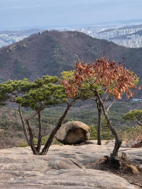
Bukhansan National Park sits inside Seoul’s city limits. That sentence still doesn’t quite land the first time you read it. A UNESCO-recognized national park — drawing an estimated 5 million visitors annually, one of the highest per-unit-area figures of any national park on Earth — accessible by subway from Gangnam in under an hour. The Baegundae Peak trail climbs to 836 meters. On a clear April morning, you can see the Han River from the summit.
The spring window is narrow and brutal in its beauty. Azaleas detonate across the ridgeline in mid-April. By early May, they’re gone. Miss it by a week and you’ve missed it entirely.
For first-timers: the Ui-Dong entrance is the most straightforward access point for foreign visitors. Trail signs are bilingual. Rescue stations are marked in red every 500 meters. The mountain has a documented history of ankle injuries near the Insubong granite face — trail shoes, not sneakers.
📍 Bukhansan National Park (북한산국립공원)
- Address: 262 Bogungmun-ro, Dobong-gu, Seoul
- Hours: Open year-round; trail access from sunrise
- Admission: Free
- Getting there: Subway Line 4 to Suyu Station, then bus 120 or 153 to Ui-Dong entrance
- Official site: https://bukhan.knps.or.kr
2. Seoraksan (설악산): Where Spring Arrives Last and Hits Hardest
Seoraksan sits in Gangwon Province, roughly three hours from Seoul by express bus. At 1,708 meters, Daecheongbong Peak is the third-highest point in South Korea. Spring doesn’t arrive here until late April — almost a full month behind Seoul — which means the azalea bloom, the snowmelt streams, and the first warm air all collide at once. The effect is cinematic in a way that feels almost unfair.
The Osaek trail on the southern approach is less crowded than the Sokcho entrance and rewards with views the Instagram version of this mountain doesn’t capture: the granite spires of Ulsanbawi at golden hour, the sound of meltwater threading through pine. The Ulsanbawi Rock loop (6 km, approximately 3–4 hours) is the trail most foreign visitors complete in a single day.
One practical note: the Sokcho intercity bus terminal is the main gateway. Taxis from the terminal to the park entrance run around 10,000–15,000 KRW (as of 2024). No subway access. Sort the logistics before you land.
📍 Seoraksan National Park (설악산국립공원)
- Address: 833 Seorak-ro, Sokcho-si, Gangwon-do
- Hours: Open year-round; specific trail sections may close seasonally
- Admission: 3,500 KRW per adult
- Getting there: Express bus from Seoul’s Dong Seoul Terminal to Sokcho (approx. 2.5–3 hrs), then local bus or taxi to park entrance
- Official site: https://seorak.knps.or.kr
3. Jirisan (지리산): The Mountain That Demands Respect
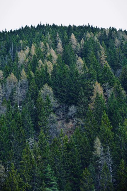
Jirisan is the largest national park in South Korea by land area — 483 square kilometers spanning three provinces. Its main ridge traverse, from Nogodan Peak to Cheonwangbong Peak, covers 25 kilometers and takes most experienced hikers two full days with an overnight at one of the park’s mountain shelters (sanjang). This is not a day hike. It is an expedition inside a country the size of Indiana.
Spring on Jirisan is defined by wild royal azaleas — cheoljjuk — blanketing Nogodan and the Baemsagol Valley in early May. Koreans drive from Seoul specifically for this. The valley floor trail through Baemsagol is 8 km one way and accessible to hikers of moderate fitness. The summit push to Cheonwangbong (1,915 meters) is a different category entirely.
Shelter reservations are mandatory and fill weeks in advance during peak spring season. Book tours in advance through the Korea National Park Service reservation system. Showing up without a reservation and expecting a bed is a mistake that has stranded more than a few unprepared foreign visitors at altitude after dark.
📍 Jirisan National Park (지리산국립공원)
- Address: 1 Jirisan-ro, Masan-myeon, Hamyang-gun, Gyeongsangnam-do (Nogodan entrance)
- Hours: Open year-round; shelter reservations required for overnight stays
- Admission: Free
- Getting there: Bus from Gwangju or Jinju to Gurye or Hamyang, then local bus to trailhead
- Official site: https://jiri.knps.or.kr
4. Hallasan (한라산): The Summit That Requires a Permit
Hallasan is a volcano. Not a metaphor — an actual shield volcano rising 1,950 meters from the center of Jeju Island, the highest peak in South Korea. The summit trail (Seongpanak or Gwaneumsa routes) requires a timed entry permit introduced in 2023 to manage the estimated 1.2 million annual visitors. The permit system is online-only, Korean-language dominant, and requires advance planning. Foreign visitors who arrive at the trailhead without a permit are turned away. This happens regularly.
Spring brings hallabong orange blossoms in the lowlands and snow patches on the upper crater rim simultaneously — a visual contradiction that defines Jeju’s micro-climate. The Eorimok trail (5.1 km to Witseoreum shelter, no summit access) is the most accessible spring route and blooms with royal azaleas in late April.
Jeju is a one-hour flight from Seoul’s Gimpo Airport. Budget airlines (Jeju Air, T’way) run the route for as low as 30,000–50,000 KRW one-way (2024 pricing). The island operates entirely differently from the mainland. Rent a car. The bus system works, but only just.
📍 Hallasan National Park (한라산국립공원)
- Address: 1100-ro, Jeju-si, Jeju-do
- Hours: Trail-dependent; summit trails require departure before specific cutoff times
- Admission: Free; summit permit required (book via Korea National Park Service website)
- Getting there: Fly to Jeju International Airport; rent a car or take bus 281 toward 1100 Road
- Official site: https://halla.knps.or.kr
5. Gyeryongsan (계룡산): The Shaman Mountain
Gyeryongsan doesn’t appear on most foreign travel itineraries. That’s the point. Located 20 kilometers southwest of Daejeon, this 845-meter mountain has been a center of Korean shamanistic practice — musok — for centuries. Shrines carved into cliff faces. Incense smoke drifting through pine corridors. The occasional mudang (shaman) conducting a gut ritual on a rock platform above the treeline. Spring amplifies everything: the azaleas, the ritual fires, the low percussion of a drum carried up on the wind.
The Sambulbong ridge trail (approximately 4 hours round trip) passes through the densest concentration of these shrines. It’s also one of the most technically interesting ridge walks in central Korea — narrow in sections, with chain assists on the steeper faces.
Gyeryongsan is 20 minutes by taxi from Daejeon KTX station. The KTX from Seoul takes 50 minutes. This is a perfectly viable day trip from Seoul that almost no foreign visitor makes. Their loss.
📍 Gyeryongsan National Park (계룡산국립공원)
- Address: 80 Gyeryongsan-ro, Banpo-myeon, Gongju-si, Chungcheongnam-do
- Hours: Open year-round
- Admission: Free
- Getting there: KTX to Daejeon Station, then taxi or bus toward Gyeryongsan (approx. 30\u201340 min)
- Official site: https://gyeryong.knps.or.kr
6. Odaesan (오대산): Buddhist Silence at 1,563 Meters
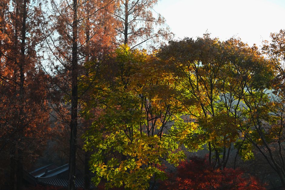
Odaesan operates at a different frequency. The approach through Woljeongsa temple — a 9th-century Buddhist complex set inside a fir forest — recalibrates your pace before the trail even begins. The fir trees lining the path are over 300 years old. They don’t hurry. Neither should you.
The Birobong summit trail (approximately 4.5 hours round trip from Sangwonsa temple) passes through old-growth forest that survived Japanese colonial-era logging — one of the few intact ancient forest corridors left in the country. The air smells of cold resin and damp earth. Spring wildflowers emerge here two weeks later than in Seoul, effectively extending the season for anyone who times it right.
📍 Odaesan National Park (오대산국립공원)
- Address: 374-8 Odaesan-ro, Jinbu-myeon, Pyeongchang-gun, Gangwon-do
- Hours: Open year-round
- Admission: Free (Woljeongsa temple entry: 4,000 KRW per adult)
- Getting there: KTX to Jinbu Station, then taxi to Woljeongsa entrance (approx. 20 min)
- Official site: https://odae.knps.or.kr
7. Naejangsan (내장산): The Azalea Corridor
Naejangsan is famous in autumn for maple foliage. That reputation obscures what it does in spring: the inner valley — naejang means “hidden inside” — fills with azaleas from late April in a density that makes the trail feel like a tunnel of pink. The 6.5 km inner valley loop is manageable in three hours and requires no technical skill. It is, however, routinely overcrowded on weekends in late April. Arrive before 8 a.m. or accept that you’re sharing the azalea tunnel with several hundred strangers.
📍 Naejangsan National Park (내장산국립공원)
- Address: 390 Naejangsan-ro, Jeongeup-si, Jeollabuk-do
- Hours: Open year-round
- Admission: 3,000 KRW per adult
- Getting there: KTX or bus to Jeongeup, then local bus or taxi to park entrance (approx. 20 min)
- Official site: https://naejang.knps.or.kr
8. Chuwolsan (추월산): The Trail Nobody Talks About
Chuwolsan sits at 731 meters in South Jeolla Province and receives a fraction of the attention its neighbors do. That is its entire value proposition. The ridge trail offers unobstructed views over Damyang’s bamboo forests and the Juam Reservoir — a landscape combination that exists nowhere else in Korea. Spring cherry blossoms along the reservoir access road in early April arrive before the crowds that descend on the better-known sites.
There are no bilingual signs. No tourist infrastructure to speak of. The trailhead is a 20-minute taxi ride from Damyang town. Bring a downloaded offline map — Naver Maps and KakaoMap both work offline in Korea. This is the trail for travelers who have already done the famous ones and want something that feels earned.
📍 Chuwolsan (추월산)
- Address: Chuwol-ri, Yongmyon, Damyang-gun, Jeollanam-do
- Hours: Open year-round
- Admission: Free
- Getting there: Bus or KTX to Gwangju, then bus to Damyang, then taxi to trailhead
- Official site: —
9. Gayasan (가야산): The Mountain of the Tripitaka
Gayasan’s summit — Sangwangbong, 1,430 meters — is one of the most dramatic in Korea: bare granite towers above the treeline in a configuration that Korean landscape painters have been reproducing for a thousand years. At the base sits Haeinsa temple, home to the Tripitaka Koreana, 81,258 wooden printing blocks carved in the 13th century and still intact. The temple is a UNESCO World Heritage Site. The mountain above it is almost entirely ignored by foreign visitors.
The Baengnyunsa trail (approximately 4 hours round trip) is the primary summit route. Spring snowmelt runs through the valley below Haeinsa through April, audible long before it’s visible through the trees. The combination of religious architecture, moving water, and granite ridge is a sequence that rewards a full day — not a rushed morning.
📍 Gayasan National Park (가야산국립공원)
- Address: 122 Haeinsa-gil, Gaya-myeon, Hapcheon-gun, Gyeongsangnam-do
- Hours: Open year-round; Haeinsa temple hours vary
- Admission: 3,000 KRW per adult (includes temple access)
- Getting there: Bus from Daegu Seobu Terminal to Haeinsa (approx. 1.5 hrs)
- Official site: https://gaya.knps.or.kr
10. Dobongsan (도봉산): The Commuter’s Ridge
Dobongsan shares a national park boundary with Bukhansan but lives in its shadow. The Jaunbong ridge trail (740 meters) is technically more demanding than most of Bukhansan’s popular routes — narrow, with exposed sections that require hands-on scrambling — and far less crowded. It’s accessible from Dobongsan Station on Seoul Subway Line 1 in under an hour from central Seoul. The spring azalea bloom on the upper ridge typically peaks in the third week of April.
This is the trail Seoul’s serious hikers use when they want Bukhansan’s proximity without its weekend circus. The difference in atmosphere between the two mountains — just three kilometers apart — is measurable the moment you step onto the ridge.
📍 Dobongsan (도봉산) — Bukhansan National Park
- Address: Dobong-dong, Dobong-gu, Seoul
- Hours: Open year-round
- Admission: Free
- Getting there: Seoul Subway Line 1 to Dobongsan Station, then 10-minute walk to trailhead
- Official site: https://bukhan.knps.or.kr
What Happens When It Goes Wrong: A Real Scenario
A foreign hiker on Seoraksan’s Daecheongbong trail in April — late afternoon, summit push, underestimated the descent time — twists an ankle on wet granite at 1,400 meters. No Korean. Phone battery at 12%. This is not hypothetical. The Korea National Park Service operates a mountain rescue system with designated emergency call points marked on every official trail map. The emergency number is 119 — the same line used for fire and ambulance. Operators have English-language support, though response time varies by region.
The practical protocol: download the Safe Mountain app (산행정보 앱) before the hike. It provides GPS location sharing with emergency services and works in offline mode. Register your trail entry at the park entrance kiosk — most major parks have English-option terminals. Tell someone your planned return time. To stay connected in the backcountry, consider a Korean eSIM for reliable mobile data. These are not suggestions for the cautious. They are the baseline for anyone hiking above 1,000 meters in a foreign country where you cannot read the warning signs.
The mountain doesn’t care about your itinerary. It never did. The hikers who understand this are the ones who come back.
The Spring Window, by the Numbers
- Cherry blossoms in Seoul: late March to early April (approximately 7–10 days peak)
- Azalea bloom at mid-elevation (500–800m): mid to late April
- Azalea bloom at high elevation (1,000m+): late April to mid-May
- Average trail temperature at 1,000m in April: 5–12°C (bring a layer)
- Sunrise at Seoul latitude in late April: approximately 5:40 a.m.
The window is real and it closes. Korean hikers track bloom forecasts the way surfers track swell reports. The Korea Meteorological Administration publishes cherry blossom and azalea forecasts annually starting in March. The data is in Korean. The blooms are not.
Rover’s Take
Korea built a hiking culture out of a landscape that left it no choice — and the trails that resulted are among the most accessible, most dramatic, and most overlooked in Asia. The only tragedy is that most foreign visitors see them from a cable car.