
At 1,915 meters above sea level, Hallasan (한라산) doesn’t ask if you’re ready. It just shows you what winter means.
South Korea’s winters are not decorative. From late November through February, temperatures in the mountain regions drop to minus 15°C or lower — colder than many parts of Scandinavia at the same latitude. Yet every year, hundreds of thousands of hikers from across the world strap on crampons, pull on base layers, and walk directly into it. Not despite the cold. Because of it.
This is not a country that shuts down in winter. It opens differently.

Why Winter Hiking in Korea Hits Different
Korea has 22 national parks. In summer, the most popular trails on Seoraksan (설악산) and Jirisan (지리산) see daily foot traffic comparable to a subway station — over 10,000 visitors per day at peak season, according to the Korea National Park Service (2023). In January, that number drops by roughly 60 to 70 percent. The trails don’t close. The crowds simply leave.
What remains is something most tourists never see: Korea in silence. Frozen waterfalls suspended mid-fall. Pine branches bent low under the weight of overnight snow. Ridge lines so sharp and white they look drawn by hand.
The contrast isn’t just visual. It’s physical. Every step on a snow-packed trail demands deliberate attention. You stop thinking about your phone. You stop thinking about your itinerary. The mountain consumes the entire bandwidth of your body — and somehow, that feels like rest.
“The trail doesn’t change. You do.” — A sentiment repeated by Korean hikers who return to the same peak every January, year after year.
The Three Trails That Define Korean Winter Hiking
1. Hallasan: The Summit That Earns Its View
Jeju Island’s Hallasan is the highest peak in South Korea. Its Yeongsil (영실) and Eorimok (어리목) trails are open year-round, but the Witseoreum shelter route — which leads closest to the summit crater — operates under strict seasonal conditions. Winter closures can happen with less than an hour’s notice when wind speeds exceed 14 meters per second. Visitors have been turned back at 1,700 meters with the summit in plain sight.
That’s not a failure. That’s the mountain’s terms.
On clear days in January, the crater lake Baengnokdam (백록담) sits frozen and bone-white at the top, ringed by volcanic rock dusted with snow. The island below disappears into cloud. You are, briefly, above the weather.
📍 Hallasan National Park
- Address: 15 Hallasan-ro, Jeju-si, Jeju-do (제주도 제주시 한라산로 15)
- Hours: Varies by trail and season; winter entry cutoff typically 06:00–12:00 depending on route
- Admission: Free
- Getting there: Bus 740 from Jeju City Terminal to Eorimok trailhead; taxi from Jeju International Airport approximately 40 minutes
- Official site: https://www.hallasan.go.kr
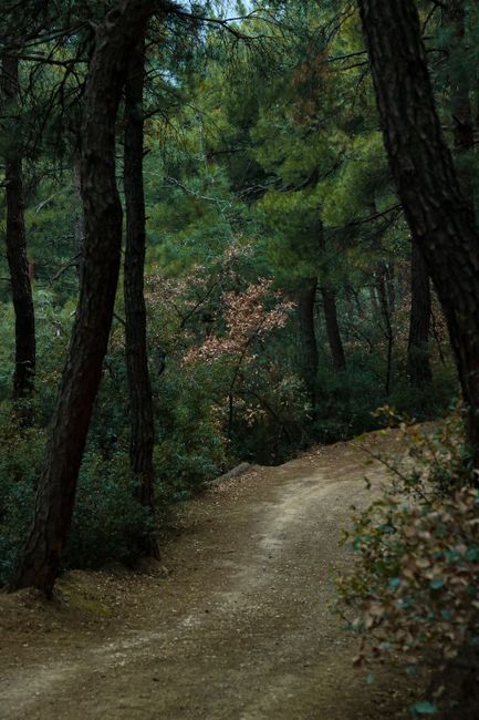
2. Seoraksan: Where the Snow Arrives First
In the Taebaek mountain range on the northeast coast, Seoraksan (설악산) receives the Korean peninsula’s first significant snowfall — sometimes as early as late October. By January, the Daecheongbong (대청봉) summit route is a full crampons-required ascent. The trail gains roughly 1,200 meters in elevation over 7.5 kilometers from the Sokcho-side entrance. That’s not a casual afternoon.
The Biryong Falls (비룡폭포) section of the inner trail freezes into a vertical wall of blue-white ice. Climbers come specifically to practice ice techniques here. Hikers come to stand before it and feel appropriately small.
Seoraksan in winter also presents a logistical reality that catches many foreign visitors off guard: the last cable car from Gwongeumseong (권금성) runs earlier in winter — often by 4:30 PM — and the mountain’s shadow means temperatures drop sharply after 3:00 PM even on sunny days. A hiker who starts the Daecheongbong summit trail at noon in July can finish comfortably. In January, the same start time is a mistake with consequences.
📍 Seoraksan National Park
- Address: 833 Seoraksan-ro, Sokcho-si, Gangwon-do (강원도 속초시 설악산로 833)
- Hours: Open year-round; winter entry restrictions apply on summit routes — check the Korea National Park Service website before departure
- Admission: Free (cable car separate: approximately KRW 13,000 round trip as of 2024)
- Getting there: Express bus from Seoul Dong Seoul Terminal to Sokcho (approx. 2.5 hours); local bus 7 or 7-1 from Sokcho Bus Terminal to park entrance
- Official site: https://seorak.knps.or.kr
3. Deogyusan: The Underrated One
Most foreign visitors have never heard of Deogyusan (덕유산). That’s precisely the point.
Located in North Jeolla Province, Deogyusan’s Hyangjeok Peak (향적봉) sits at 1,614 meters and is accessible via gondola from the Muju Deogyusan Resort (무주덕유산리조트) — making it one of the few peaks in Korea where you can reach near-summit elevation without a full-day hike. In winter, the ridge trail from the gondola’s top station to Hyangjeok Peak runs through a corridor of frost-covered trees called sanghwa (상고대), a natural phenomenon where supercooled water vapor freezes directly onto branches overnight. The result looks less like snow and more like the mountain has grown white fur.
It appears for a few hours after sunrise on specific mornings. There is no schedule for it. You either arrive early enough, or you don’t see it at all.
📍 Deogyusan National Park
- Address: 207 Mujugucheondong-ro, Seolcheon-myeon, Muju-gun, Jeollabuk-do (전북 무주군 설천면 무주구천동로 207)
- Hours: Open year-round; gondola hours vary by season
- Admission: Free (gondola separate)
- Getting there: Bus from Daejeon or Jeonju to Muju; local taxi to resort entrance
- Official site: https://deogyusan.knps.or.kr
What Actually Happens When Things Go Wrong
Here is a scenario that plays out more than once every winter season in Korea’s national parks:
A foreign visitor — traveling solo, carrying a phone at 30% battery, wearing trail runners instead of hiking boots — reaches the halfway point of a summit trail around 1:00 PM. The sky is clear. The path looks manageable. An hour later, cloud rolls in from the west. The temperature drops 6°C in twenty minutes. The trail, which was packed snow on the way up, is now a sheet of ice on the descent. The visitor doesn’t have crampons. They didn’t know they were required. The signage at the trailhead was in Korean.
This is not hypothetical. Korea’s national park rescue teams (산악구조대) respond to hundreds of calls per year, and winter incidents spike disproportionately among hikers who underestimated gear requirements. The Korea National Park Service website provides English-language trail condition updates, but many visitors don’t check them before arrival. Park rangers at major trailheads speak limited English — enough to point, not enough to fully explain a weather advisory.
The practical reality: bring crampons or microspikes for any trail above 800 meters between December and February. Rent them at outdoor gear shops in Sokcho or at Muju Resort if you don’t own a pair. A basic set runs KRW 5,000 to 15,000 per day at most rental shops near major trailheads. If you twist an ankle on a remote section of trail, the emergency number is 119 — the operator will connect you to an English-speaking service, but your GPS coordinates matter more than your vocabulary. Most Korean hiking apps, including Naver Map (네이버 지도), display your current location coordinates. Stay connected with a local eSIM to ensure you don’t lose signal.
The Gear Gap: What Korean Hikers Know That You Don’t
Korean outdoor culture is not casual. The country’s mountaineering gear market was valued at approximately KRW 3 trillion (roughly USD 2.3 billion) in 2022, according to the Korea Outdoor Industry Association — a per-capita spend that rivals Switzerland. Walk through Dongdaemun’s outdoor gear district (동대문 아웃도어 거리) or the renowned Namdaemun outdoor market (남대문 아웃도어 시장) in November and you’ll see why: full Gore-Tex shell systems, layering setups that would be at home at Everest base camp, trekking poles with snow baskets already attached.
This is not fashion. Korean winters at elevation are genuinely technical environments. The wind chill on Seoraksan’s exposed ridgeline in February can push the perceived temperature below minus 25°C. The sanghwa frost phenomenon that makes Deogyusan so visually stunning also signals ambient humidity levels that make cotton clothing a liability. Korean hikers have a phrase for under-prepared winter hikers: deung-sani (등산이) who treat the mountain like a park. The mountain eventually teaches them otherwise.
The Seasonal Window: When to Go, and When Not To
Peak winter hiking conditions in Korea run from late December through mid-February. January is the coldest month nationally, with average temperatures at summit elevations ranging from minus 10°C to minus 18°C depending on location and wind. February marks the slow transition — snow remains, but the angle of light shifts. By late February, the first hints of rime ice melting off the branches begin to appear. The trails are still winter. The light is not.
March is a different country entirely. The cherry blossoms on Jeju begin as early as late March, and the same Hallasan trails that were frozen solid in January become corridors of pink and white. Korea’s hiking seasons don’t blend into one another. They arrive in full, stay completely, and leave without warning.
That’s the rhythm worth planning around.
Rover’s Take
Korea’s winter mountains don’t reward the unprepared — but they don’t punish curiosity either. They simply require that you show up as seriously as they do.